Saturday, June 22, 2013

World Heritage "curse"?


Later this summer I'll be biking through a part of the Loire Valley that's been designated a UNESCO World Heritage Site.  The designation, which only occurred about ten years ago, is meant to help preserve, and at the same time draw attention to, the remarkable chateaux along the middle portion of the river, and to their history.  I suppose it's not unexpected that these two objectives should end up creating tensions.  The people who want to draw in tourists and the people who want to preserve sites aren't necessarily the same.  And once the UNESCO designation has been achieved, they aren't likely to have the same interests.  In fact, they may well end up in conflict.

A recent example of this is the Loreley Plateau, a site along the middle portion of the Rhine River, about 80 km west of Frankfurt, Germany.  (Hat tip to M. McDonald)  The plateau is at the top of a nearly 400 foot-high rock at the narrowest point of the Rhine.  The rocks below and the turbulence in the river have caused numerous accidents over the years and helped give rise to local legends.  In 2002, the rock and the plateau were included in a 65 km stretch of the river receiving UNESCO World Heritage designation.

Google Satellite identifies several hotels, restaurants and a sizable camping ground on the plateau, all of which feature great views above the river and probably benefit from the UNESCO designation.  But it seems that a recently-constructed summer bobsled run was one thing too many. 
http://www.spiegel.de
Just this week, the World Heritage Committee issued a statement declaring that the run was "not compatible with the outstanding universal value of the World Heritage property" and calling for its removal.

I'll be on the lookout for tourism run amok when I'm riding past the Loire chateaux.  But I have to say I have trouble seeing this bobsled run as an example.  The World Heritage Committee seems to be okay with places to eat and sleep and park your camper van.  But the bobsled run seems to strike them as just too touristy, too tackily mass touristy. 

http://www.spiegel.de
 I'd probably prefer a beer on one of the restaurant terraces before I took a run on the bobsled.  But it's a little hard to see, from the photo here, how it has more of an impact on the site than do the other tourist facilities.

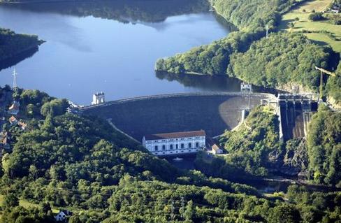
Meanwhile, commercial barge traffic continues along this stretch of the river below and a little over two years ago one of them capsized near the Loreley rock spilling 2,400 tons sulphuric acid into the river.  One wonders whether the barges and their cargos are "compatible with the outstanding universal value of the World Heritage property?"

Thursday, June 20, 2013

Messy is better


Could a small boat, a chainsaw, and a hand winch be enough to bring a river back to life?  Possibly, in some cases.  An example comes from the River Bure, a short river, only about 50 long, flowing through Norfolk in northeastern England.  It joins the River Yare at Great Yarmouth just before reaching the North Sea.


A little north of the city of Norwich, the river passes through the Blickling Estate, a large country house and grounds managed by England's National Trust since the 1940s.  In the past, the river had been dredged and meanders blocked off to accommodate several nearby mills using the water power.  Trees that might fall into the river were regularly cleared away.  A visitor to the Estate might see an attractive country steam (below), but, in fact, the channelizing and debris clearing had seriously undermined its vitality.   


© D. Brady.  The National Trust
These measures, it appears, had caused the flow of water to slow down.  As it did so, silt, normally carried farther downstream, fell out and gradually covered over the gravel in the river bed.  Over time this process eliminated many of the spawning grounds for the local brown trout.  Eventually local fishermen and National Trust staff realized something needed to be done to improve the river's ability to support the fish and other plant and animal life.
 

In 2008 and 2010 the two groups undertook to recreate something like natural stream conditions.  This turned out to be fairly easy.  They carefully picked out trees that looked like they were about to fall into the river on their own, cut them, and let them fall into the river, branches, leaves and all.  In a few cases, they needed the hand winch to drag them into the water.

The result has been impressive.  As water squeezed its way around and through the debris, it accelerated and, in doing so, began to wash the silt off of the gravel.  With this, the trout began to return to spawn; the fishermen have recorded their increased numbers.  Some of the silt has been displaced out to the river banks where it has allowed new plants to take root.

© D. Brady.  The National Trust

The result (here) may be a messier looking river, but it appears to be much healthier.  And the lesson has been picked up by environmental agencies in the area; they are now much more likely to let trees that fall into streams just stay there.


Friday, June 14, 2013

Building up protections

Give New York credit for its efforts to learn from last year's Hurricane Sandy.  Less a year after the storm that causing more than $19 billion in damage, New York City, following the State, has now announced proposals aimed at reducing risks of similar damage in future storms. 
 

Last Tuesday, NYC mayor, Michael Bloomberg, described plans to protect vulnerable buildings along the city's 520-mile floodplain.  The proposals including modifying new and existing buildings to reinforce foundations, as well as raise the levels of critical equipment.  They also include proposals to build a system of flood walls, levees, and bulkheads at critical points around the city.  The total cost is estimated at $20 billion, although most expect it to go higher as measures would be implemented.

As I noted the other day, New York City currently has nearly 400,000 people living and working within its 100-year flood plain (which these days are often more like 50-year flood plains).  Generally, the mayor's proposals are aimed at protecting those residents, and in addition, allowing for that number to double over the next 30 years or so.


What's more, the proposals include one seemingly head-scratching idea to use new residential and office development as a means of protecting against storm surge.  The report describes a project the mayor referred to as Seaport City, a complex of apartments and office buildings to be built on landfill extending out from the shoreline below the Brooklyn Bridge.  Quite possibly I'm missing something, but it seems that, while the new development might protect existing territory along that part of the East Side, the new developments would themselves become the at-risk, exposed buildings. 

I know New York City is very different from coastal areas on Long Island where Governor Cuomo has proposed paying landowners to give up their houses and permit the coast to return to something like a natural protective system of dunes and marshes.  I suspect that there's little, if any, of the New York City floodplain where anything similar would be possible.  Still, as one researcher observed, you "can't guarantee protection for infrastructure that is in vulnerable locations."  Yet Mayor Bloomberg's proposals seem prepared to try. 


I'm hoping an interesting debate will follow since there's a lot I need to learn.

Tuesday, June 11, 2013

Waterfront property

What is it about living near water that's so attractive?  In the past it was easier to understand.  Waterways were sources of power for milling and early manufacture.  And oceans and rivers were transportation routes.  People lived near water probably without thinking too much about it.  They were simply living close to their work.  But why now when we have so many alternatives to water power and water-based transportation?  Nearly everywhere it seems developers push to offer more waterfront residences, local governments anxious about tax revenues approve them, and and people buy them, both as first and second homes.

And then come hurricanes and floods.  But somehow these disasters seem to have little effect on the waterfront development machine.  These thoughts come from reading a couple of recent New York Times articles.  One, on high water levels and flooding along the Danube in Austria and Hungary, noted that part of the reason for record high water levels was the reduced ability of river flood plains to absorb it. 
A Budapest neighborhood,  June 9, 2013. © Reuters/Laszlo Balogh
It cited a study from the Hungarian national water authority reporting that "the decreased drainage capacity of the Hungarian flood protection system was due largely to increased building on former floodplains along rivers."

The other was an article today on new warnings of risks posed to New york City from climate change, especially rising sea levels.  The City report noted that already some 398,000 people live within the 100-year flood plain.  But, rather than seeing that number reduced, the report expects it will more than double over the next 35 years or so.  It seems that mermaids' fatal siren songs are now sung by real estate developers.

Monday, June 10, 2013

No Big Ships!

Yesterday's post turned out to be more timely than I knew.  More or less while I was drafting it, demonstrators were winding up a weekend of protests against the large cruise ships passing through the Giudecca Canal.  On Sunday, supporters of No Grandi Navi (No Big Ships) lined up at the Stazione Marittima at the port of Venice to block passengers' access to the ships.  Later, dozens of small boats occupied the Giudecca Canal to prevent one of the ships from leaving. 
© Giornalettismo.com
Ultimately, darkness, rain, and wind ended the small boat blockade and the ship departed about three hours late.  


The demonstrators' larger purpose had been to send a message to Venice mayor, Giorgio Orsoni.  Orsoni is due to meet later this week with Minister of Infrastructure and Transport, Maurizio Lupi, to discuss new docking arrangements for the ships.  One option would be to develop new basins inside the lagoon at Maghera.  No Grandi Navi, however, wants the ships kept completely out of the lagoon and favors an off-shore facility from which visitors would be ferried into the city.  Anna Somers Cocks, in her NYRB article (see link in yesterday's post), suggests that the real power in the lagoon is not the mayor, but the head of the Autorità Portuale di Venezia (Venice Port Authority), Paolo Costa.  And, she says, he favors arrangements that would remain within his jurisdiction, i.e., something inside the lagoon.

Sunday, June 9, 2013

Venice inundated

I touched on the problem of large cruise ships invading Venice once before.  These floating multi-story hotels, crowding into the Giudecca Canal, bringing thousands of passengers up close to the Doge's Palace and the Campanile in Piazza San Marco, are part of a larger complex of issues connected to how to save the city from tourism and from rising sea waters.  
© Andrea Pattaro/AFP
 Anna Somers Cocks, in a recent issue of The New York Review of Books, discusses all of this.  It's an excellent and unsettling article.

In 1987, Italy sought, and was granted, designation of Venice as a UNESCO World Heritage Site.  As part of the designation agreement, Italy promised to develop and implement a management plan for the city and a buffer zone around it.  The French chateaux in the Loire Valley are protected by such a plan.  Only in November of last year did the Venice City Council publish a plan, 25 years after the original World Heritage designation.  Cocks, a former chairman of the Venice in Peril Fund and now the editor of The Art Newspaper, is deeply critical of what they produced for failing to address the critical threats to Venice.  Without significant changes in governance and political will, she fears that the city will be overwhelmed by tourists and rising sea water.

Thursday, June 6, 2013

Peaking releases and fish

Hydropower may be a clean, renewable form of energy, but putting a dam across a river certainly has consequences for life in and along a river.  This is particularly true when the power station operates in a "peaking" manner, periodically releasing water from the reservoir to supply extra power.

Recently, France's Fédération Nationale pour la Pêche (National Federation for Fishing) and Électricité de France (EDF) announced the results of a joint six-year study (2006-2011) of the impacts on the down-stream fish populations of these peaking releases (referred to as "éclusées" from the opening of the "écluses" or locks to release the water).  The report covered the first phase on an on-going evaluation and looked at water releases from the dams at La Roche-aux-Moines and Éguzon, both on the Creuse River about 50 km south of Châteauroux (about 150 km southeast of Tours and the Loire River).  Data was collected at some 50 points identified as fish spawning grounds.

Éguzon Dam.  © La Nouvelle République and Patrick Gaïda

Somewhat surprisingly, the study found that the impacts weren't all negative; they varied according to species of fish.  Some seemed to do just fine; others not so fine.  Among the former were barbels, a small carp-like fish, and chub.  Among the latter were perch, trout, and sanders, all of which showed declining numbers.


Already, EDF has agreed to modify its water releases to keep the downstream water levels within specified minimum and maximum amounts.  As reported in the newspaper La Nouvelle République the fishermen and the power company, having collaborated in this project, seemed anxious to find ways to manage the river to satisfy everyone's concerns, or at least those of fishermen and power generators.  I'm curious, though, about what regulatory requirements apply to habitat protection along rivers in cases like this, and the extent to which those are taken into account.  Is there a possibility that governmental agencies may be ceding responsibilities to private interests in this case?

Wednesday, June 5, 2013

The Gerbier is free

Among the world's rivers, France's Loire must have one of the most clearly marked starting points.  This is le Gerbier de Jonc, a volcanic mound in the department of the Ardèche, where several springs emerge from its base, quickly join, and head off for the Atlantic some 600 miles away.
© Richard Mounts


Despite being rather remote, it's estimated that the site draws nearly a half million visitors a year, many of whom pay a euro or so and push through the turnstile to hike to the top for the impressive views.  

© Richard Mounts
© Richard Mounts
Not withstanding its status as a kind of national monument, le Gerbier and the surrounding land is privately-held.  But starting this summer, the admission charges will be dropped and access will be free.  This comes as the result of a 30-year agreement between the land owners and the department of the Ardèche.

I worry about too many people climbing over an already fragile ecology.  But apparently the department plans new protective measures, along with programs to highlight the unique characteristics of the setting.  I may have to go back.